
The Sanctuary of the Rock People - Joshua Tree National Park
Explor Dates: October 2-3, 2022
Ok, sometimes a title takes an explanation. I was playing around with a Sci Fi random book title generator the other day and it spit that out. I liked it.
I am not an anti-rockite. I like them all; small, medium and Jumbo. Igneous, metamorphic, sedimentary - they’re all good. I like to scramble on them, climb them, fall off them and get scraped and abraided by them. But I especially like to photograph them.
I am a rock people.
And Joshua Tree National Park is definitely a sanctuary. So it all comes together 😀.
I hit the road Saturday after work and thanks to some horrible traffic and a quick stop at McDonald’s, arrived in Twentynine Palms three hours later. That drive would normally would take a little over two hours. Oh well, I guess a LOT of people were fleeing the city the same as I was. But with my lodging at the Twin Tanks Desert Homestead Cabins already booked, there was no need to worry. I just had to find the place, and not get stuck in the sand. Which turned out to be pretty easy, even in the dark. The directions from the airbnb host were spot on. Click on the link above in green to check it out, it’s pretty darn cool.
Sunday morning, into the park. No firm destination planned, just some random hiking and rock scrambling places in mind. Armed with my camera (iPhone 13 pro) and a backpack filled with snacks, drinks and some toys, looking for photo ops, let the day begin. (ok, this post and the pictures kinda got away from me. I normally don’t talk much, but when I get on a roll, I can throw a lot of words into a blog)
One of the many cool things about where I spent the nights, you can actually hike up a wash behind the homestead to Indian Cove campground, which is part of JTNP. It’s got some fantastic rocks to scramble, climb, photo. And at the east end of the campground is Rattlesnake Canyon. I wonder how that got its name….🐍
At times after heavy rainfall in the right areas, Rattlesnake Creek comes to life in Rattlesnake Canyon. Following a tip that there was flowing water in the creek just a few days earlier, I set out to see if it was still running. Parking at the trailhead (there really is no trail, it’s an extremely difficult hike up the canyon with nearly every yard gained being achieved by climbing over large rocks, be prepared if you plan on hiking up the canyon), I looked for an easy path. Then I heard the sound of tiny waterfalls babbling, so I knew I had to press on. I’m glad I did.
Something rarely seen in JT, a stream of running water. I only climbed up the canyon a little ways, after falling twice I figured I’d gone far enough. There were probably some larger pools higher up, but I was happy getting the photos that I did. Thanks for the tip, Peter!
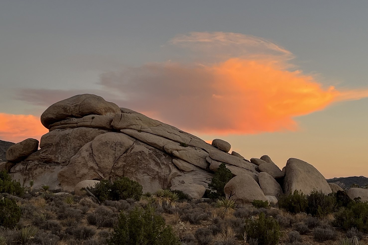
Visitors to the park all have their favorite rock[s], and each additional visit must add more to their list; so many to choose from. A rock’s color, lighting, shape, size, composition, or resemblance to an animal, a person or part of a person’s anatomy can make that rock a lasting impression, a favorite. And so many of the rocks and piles of rocks in JT are awe inspiring, they’re magnificent just sitting there in their silent grandeur. Combine that with some green plants in the foreground, some pretty clouds and a blue sky. It’s like they’re screaming, “take my picture!” I was happy to oblige, it’s so easy to shoot a thousand photos in a day. Here’s some of my favorites and some tips on where to find your own favorite rocks.
“Spooky Hollow” is a unique spot in the park, and it’s located right off Park Blvd., just a little ways east of Skull Rock. Skip the crowds at the Skull and visit the Spooky. You’ll have the entire area to yourself. And there are a number of crazy photogenic piles of granite in this vicinity. Of course, with wandering, you can see even more fascinating formations (just remember how to get back to your car if you do wander off the beaten path). I’ve stopped here many times over the years; that leaning boulder atop the pile at the right draws me in somehow. And the spooky sculpture on the left, get here just as the sun’s going down to catch it in shadow.
This jumble near Spooky Hollow always gets some snaps. That huge, diagonal dike of really large boulders is wild, and it continues up around the bend at right. And to the left of this group, there’s a small canyon that heads behind these rocks with a big diamond shaped rock that is pretty neat to see.
Depending on where you are, the Diamond Rock on the left will look more or less like a diamond shape. It’s a good one to use as a navigation help, as it can be seen at quite a distance.
And a new find for me, the photo above (apologies for it’s fuzzyness; one thing the iPhone 13 pro is not good at is telephoto shots at anything past its optical zoom, which is only 3x. Once you get into the digital zoom, the pictures suffer).
I call this formation, The Evil Bunny. You can see it, right?

Early morning (for me anyway, must have been around 9:00 am!) Creosote.

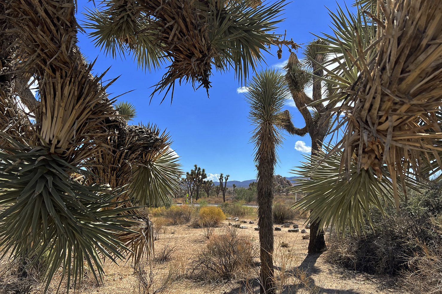
A quick panorama of Queen Valley. So many Joshua Trees out there. Might be worth an hour’s hike straight south into this forest to see what else is out there.

And a similar shot from a little farther down Park Blvd.
This has probably happened to you. Driving along through the park, something catches your eye that you want to investigate. You frantically look for a place to pull off the road. Luckily, upon spotting this miniature Headstone Rock on one side of the road and the pretty datura bloom on the other, a pull out magically appeared just past them, allowing further investigation. The surveying benchmark was located right near the baby Headstone Rock and the Jimsonweed was across the street, just a bit down the road. Sometimes it’s easy to forget that a lot of the park is at 4,000 ft elevation or higher. No wonder I’m always out of breath……
One of my favorite Joshua Trees is near baby Headstone Rock, and right on top of the road. It’s been dubbed “the Barber Pole” for as long as I can remember. That name was most likely given back in the day when it hadn’t yet branched. The faded looking photo above was taken in 1997, kinda looks like me when I was forty years younger. To learn more about the deep secrets of Joshua Trees, check out this LINK. Some quick facts: Josh grows at about 1/2” to 3” a year, there are no rings in its ‘trunk,’ and its been around for the last two million years. Josh is part of the Yucca family, the largest member, and has a fancy name: Yucca brevifolia.
A 1932 article in the New York Botanic Gardens Journal reported that the largest Joshua tree known at that time was located in the Antelope Valley about 18 miles east of Lancaster, and it was estimated to be more than 1,000 years old. It was very tall, measuring 80 feet high with a circumference of nine feet. Yikes! That would be something to see!
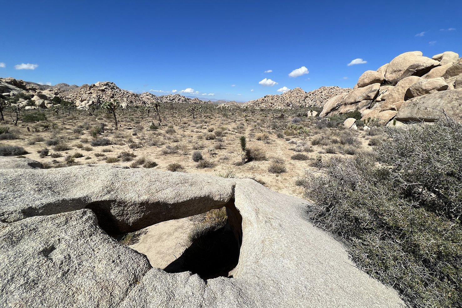
Hole in the top of a rock, a pretty neat alcove beneath it, but it wouldn’t make a great shelter as any rain would drop right in. It’s sort of a horizontal arch.

You may remember way back at the beginning of this wordy post (are you still with me?), some mention was made of toys in a backpack. One of my objectives for this trip was to work on my Toy Photography skills. Yes, Toy Photography is a thing, and it’s a fun thing. Click HERE to see some of my “Toyfolio.” I like utilizing desert gold or unique locations in my toy photos. These cans were probably part of a dump left by an early settlers in the area, or maybe from a line cabin on someone’s ranch.
Anyway, this area above is out behind Echo Rock and is a great place to explore. There are rocks to scramble on, plants, lizards, birds, all kinds of interesting things. It’s a great place to take a JT first-timer. The parking area for Echo T is off the road that leads to Barker Dam, and usually has parking spaces available, except for the most crowded days.
It’s almost like someone planted this little garden: Mojave Yucca, green leafy bush that I can’t remember the name of, Joshua Tree and a Cholla!
Lone Pine
Chuck, jr.

Don’t Fence Me In
It’s always exciting to stumble across remnants of JT’s ranching days. Here, an extensive area was once totally fenced in, most likely to keep cattle from wandering too far from home.

This huge chunk of rocks is known as “Snickers.” The ‘smaller’ upright boulders on the far right are known as “Little Rock Candy Mountain.”

See the people?
There’s a group of exploratographers out there who are always on the lookout for arch discovery. I’m not sure if any of them have seen these two, “Sleeping Arch” and “Skinny Arch.” If they have, maybe they’ll leave a comment below.

I headed down Geology Tour Road for a bit, until about two miles past where the sign said “Four Wheel Drive Recommended.” The Rav4 has all-wheel drive, but when things started getting too sandy, I decided to turn around and head back. Off to the east of GTR I saw what appears to be the famous “Snoopy Sphinx Rock.”

Not having a specific destination on this trip, I was all over the place. Here’s a view of Jumbo Rocks that caught my eye whilst driving by. Luckily, there are a couple places to park along Park Blvd. just outside the entrance to Jumbo Rocks. The south side give this nice view above. And the “other side of the road,” though less traveled, has some amazing sights to see. Check the next few pictures below.


Looking one way.
And from the other end.
This dike was pretty good size.


As the sun started to set, the Hall of Horrors area took on a nice glow. I headed out a ways to await the sunset to see the show and it didn’t disappoint.


If you’re still reading, thank you for your perseverance! I hope you had some popcorn and a drink to help you make it this far! You may have noticed, that none of the places documented here will be found in any printed guides given out by the NPS Rangers. They’re not on any maps, they aren’t pictured or discussed on any websites. That’s what makes them special. And the cool thing is, anyone can find their own special spots just by safely parking along the road in one of the turnouts and “hey, let’s go check out that pile of rocks.” Or, “I wonder what’s out there?” Just make sure you know how to find your car after exploring off track.

For more trip reports, please feel free to thoroughly search this site, there’s a lot of information. And for even more, check out the sister site at Cali49.com
If any of my pictures strike your fancy, feel free to right click on them to download to your device, for your personal use. Free, no strings, no red tape.
Are you a rock people?
Return to Joshua Tree National Park Home Page
Follow on Instagram @exploratographer


-
 GoPro or Go Home - Joshua Tree National Park https://t.co/TJAShuigdc
 -
The Barbed Wire Trail - Joshua Tree National Park https://t.co/o0FKwmB68R
-
The Sawtooth Ascent - Joshua Tree National Park https://t.co/ihgRZZfliW