
Oatman, AZ - Rt 66
I’m sure this has a name, but I couldn’t find it. Pretty impressive chunk of rock though.
Day Two of my “Goodbye God, I’m going to Texas” roadtrip (September, 2014). I left the comforts of my free room at the Tropicana in Laughlin, Nev and headed east for the Black Mountains. I was going to Oatman to see the burros. Once I left I-95 and started heading up into the mountains, the scenery became spectacular. Sheer, steep cliffs along the narrow winding road, jagged peaks, it was pretty amazing.
Spotted this creepy crawly creature along the way. I think it’s a White-lined Sphinx Caterpillar, which will turn into a very big moth with a 2”-3” wingspan. The horn is on its back end.
And in about an hour, I was in Oatman.
The obligatory photo of a baby burro. Every post about Oatman must have one.
I arrived a bit early and most of the businesses were still closed, but I walked up and down the town’s main street, interacting with the burros and taking pictures of the old buildings. It’s a pretty cool town that dates back over 100 years. A couple of prospectors struck it rich, supposedly finding a claim that yielded $10 million in gold (I always take such rich numbers with a grain of salt. I carry the salt in a small, pinch-sized container). After the find, the town boomed and folks of all kinds flooded into the area. Fires often swept through the town, the mines boomed and busted, and with the creation of Route 66, the town boomed and busted again.
The town was named in honor of Olive Oatman who, as a young girl, was kidnapped along with her sister by a Native American Tribe in Arizona Territory in 1851. She and her sister were later sold to the Mohave people, after which her sister died and Olive somehow eventually returned/was rescued in the general area of today’s Oatman some five years after she was taken. Olive received the tattoos on her face sometime during her captivity with the Mohave people.
Click HERE to visit the Olive Oatman Wikipedia page.
There’s a lot to see in town, some quite touristy, but a lot of history as well. I was in a bit of a hurry, so didn’t spend as much time in town as I could have. Another trip is definitely in the works, as well as more pictures.
There are quite a few paintings and images adorning the outside walls of some buildings, and surprising things to see in some of the storefront windows as well.
Click on any of the images to view them in a larger size.
The burros that own the streets are very friendly and are said to be descended from the original burros the miners once used back during the days of gold. When they were no longer needed, they were set free to become free range burros and have roamed the area ever since.
They wander into town in the morning looking for food and are very adept at plucking things from people’s hands, so hold onto your candy tightly. In the evening, they head back to wherever they intend to spend the night.
A minute’s worth of burro dodging.
After taking more than enough burrophotos, it was time to resume my journey. Goldroad was next as I headed towards Sitgreaves Pass. Adios, burritos!
Update from 08/08/22 - A little more info and a few more pictures.

Another shot of that amazing hill/mountain/chunk’o rock that you’ll pass by if you’re heading up the Oatman Road. Looks like some prospecting was going on out there, which isn’t surprising as I read that this area was one of the top three gold producing districts in Arizona.

It was a hazy day for some reason, perhaps due to the monsoons that were rolling through. In any case, at the south end of town are some massive mill foundation ruins left over from when the Tom Reed mine was in operation. Sometimes also referred to as the Blue Ridge, or Ben Harrison mine, the location was discovered in 1900, with production beginning around 1905 and ending around 1939. There are miles of shafts and tunnels in the hills of this area, some reaching down near 1,000 feet. Total production for the mine was reportedly around $13 million, in period dollars. I didn’t hike over to the ruins to look closer for two reasons. One, it was over 100 °F and two, I wasn’t sure if it was posted.
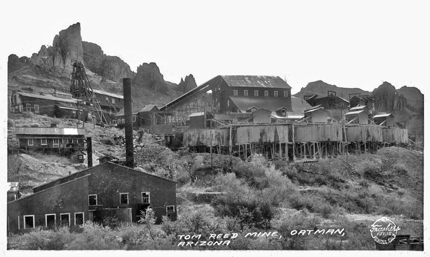
Here’s an old Frasher’s Fotos postcard of what the 20-stamp-mill and the surrounding buildings looked like back in the day.
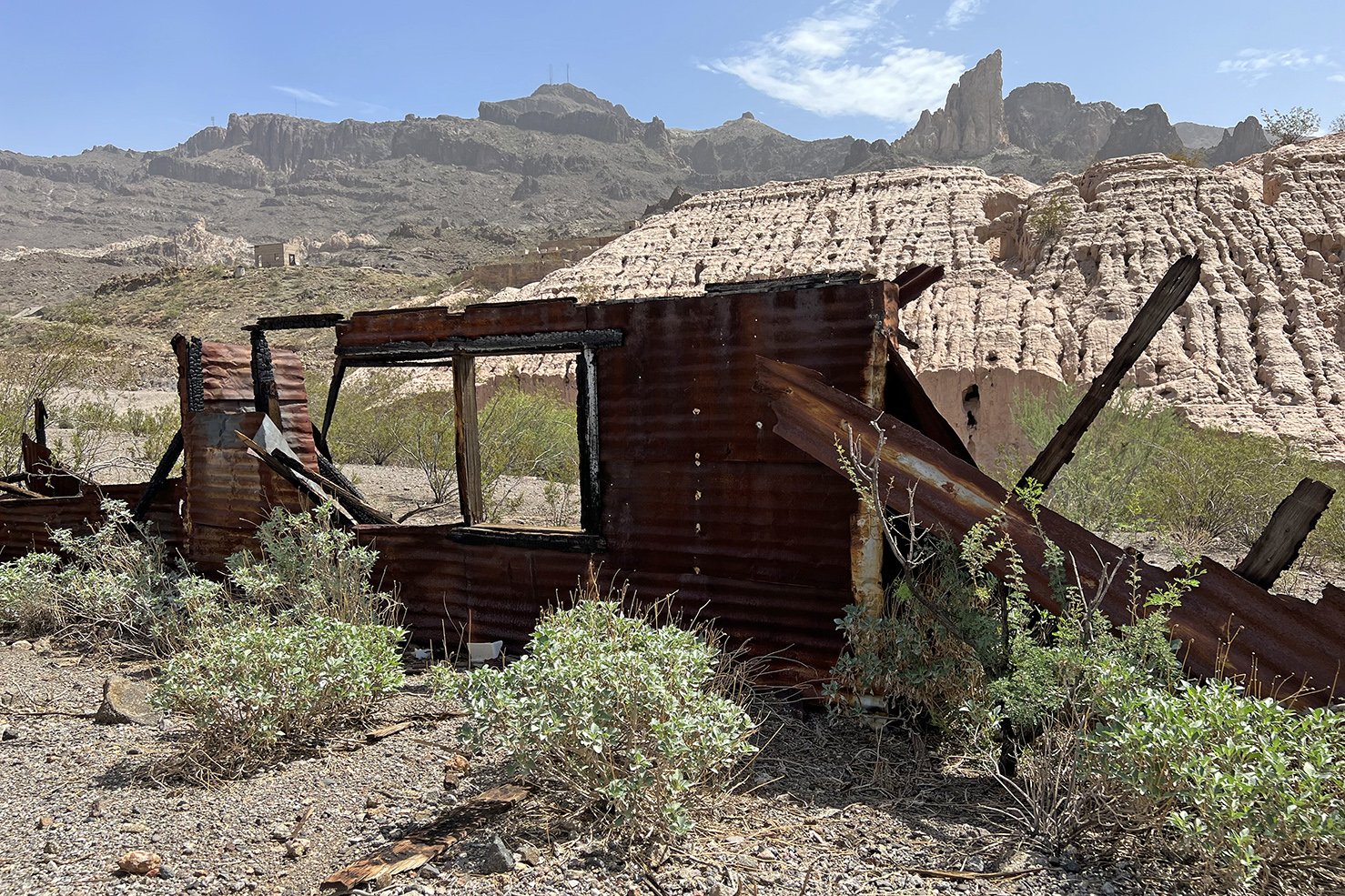
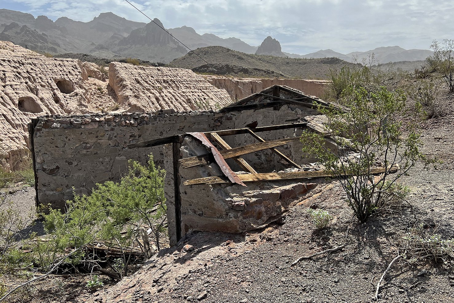
A couple cabin ruins are located near the foundation ruins. I believe that light color hill behind these two ruins is made of waste material from the mine, but am not positive about that.
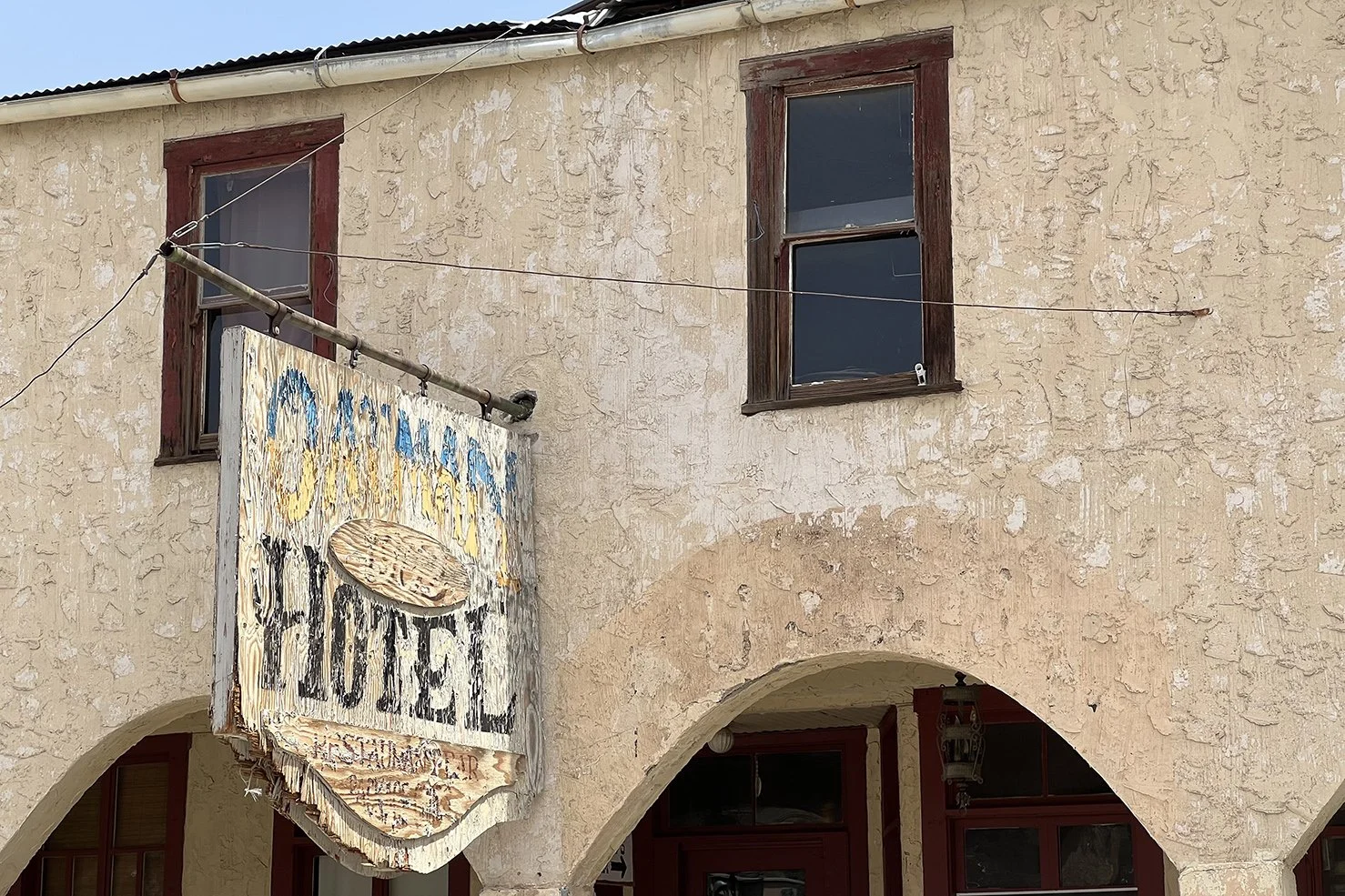

Legend (our old friend) has it that Clark Gable and Carole Lombard spent their honeymoon night in the Oatman Motel. Visitors can climb the creaky stairs up to the second floor and take a peak inside their room.
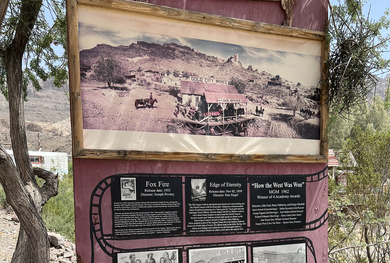
Apparently a number of film productions used the rugged area around Oatman as background for their movies. The only one I was familiar with was “How the West Was Won,” as Louis L’Amour wrote the novelization of the movie script.
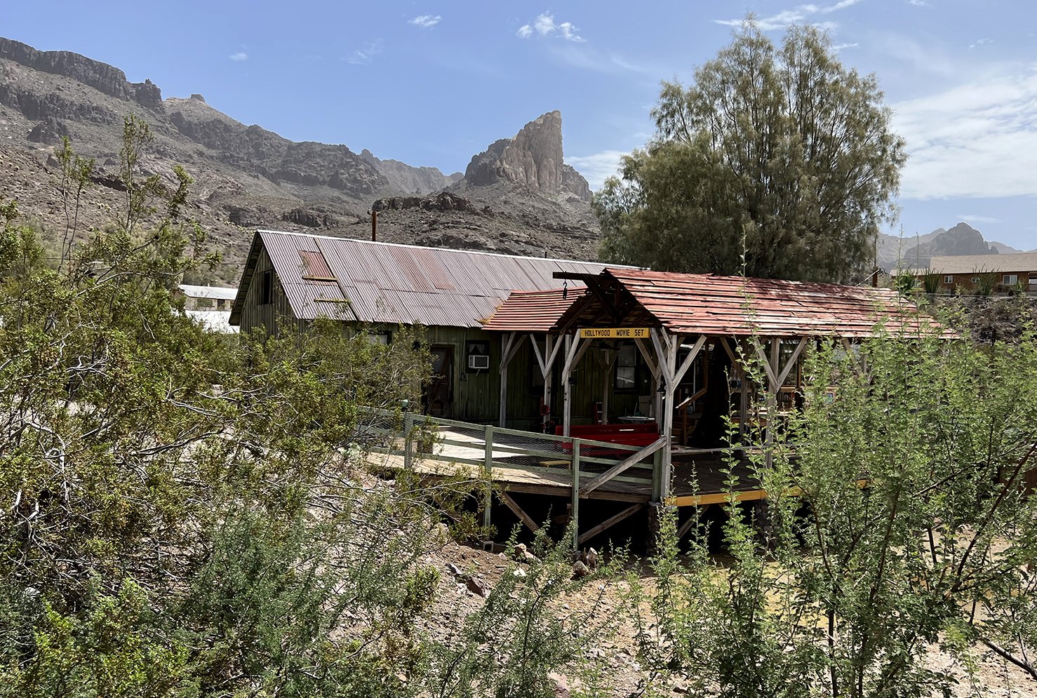
Here’s the building constructed as the “Gold City Mines” land office.

Click HERE for more Oatman information.
Return to Route 66 Home Page
-
 GoPro or Go Home - Joshua Tree National Park https://t.co/TJAShuigdc
 -
The Barbed Wire Trail - Joshua Tree National Park https://t.co/o0FKwmB68R


Follow on Instagram @exploratographer